AirNav RadarBox API Series: Flight Data
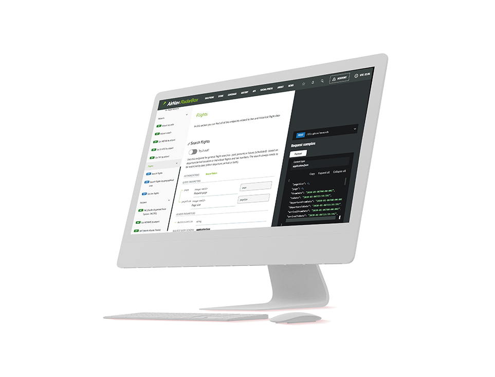
The Image Above: AirNav RadarBox API displayed on the screen
AirNav RadarBox's REST-based On-Demand API solution enables developers to seamlessly integrate real-time or historical global flight data into their applications. AirNav's ODAPI consists of 100+ customizable data fields that can be queried individually or combined based on various parameters to deliver powerful results.
These data fields include both static and live data. For example, an airport's IATA/ICAO code, latitude, and longitude, elevation, time zone would comprise the static data, while an airport's runway in use or recent takeoff and landing statistics would comprise the live data. Additionally, the On-Demand API (ODAPI) can be effortlessly integrated into customer applications based on the volume required.
The Flight Data Cateogry in particular has 3 query options:
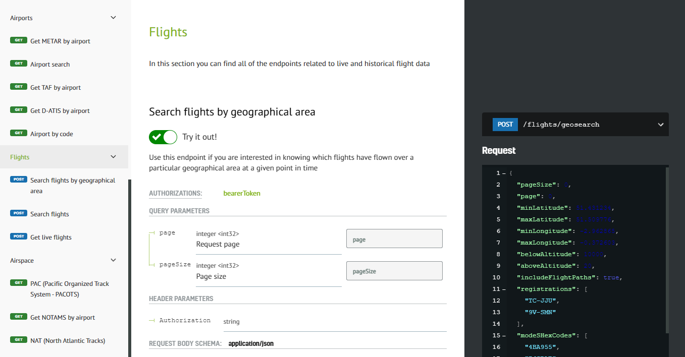
- Search flights by geographical area (latitude & longitude)
- Search for any flight based on departure/arrival, individual flights, etc
- Search for live flights

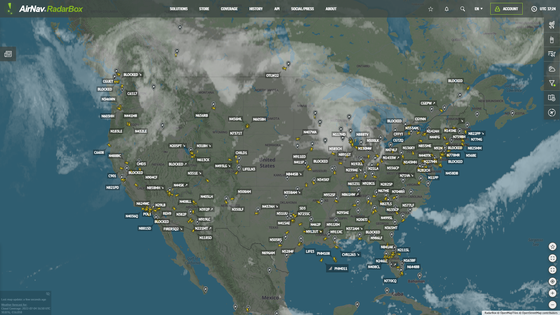
The Image Above: AirNav RadarBox Coverage Map
Our data is aggregated by our ground and satellite-based ADS-B network plus 12 different data sources (ADS-C, FAA SWIM, and so on), which include 100+ data fields such as flight number, call sign, registration, scheduled and actual departure and arrival times, aircraft speed, altitude, and other parameters.
Flight data (Live flights & Geographical Area)
To access and use RadarBox On-Demand API flight data solutions is simple, go to Radarbox.com/api/documentation -> "Flights" and query the data or flight statistics you need.
Why do customers love our API Solutions?
- Credit-per-result pricing - Pay only for what you use.
- Developer-Friendly API - Seamless integration into client applications.
- Starts at 10,000 credits/mo. - Affordability with the option to upgrade credits.
- Flight data from 12+ sources - Ensuring accuracy through redundancy.
- 24/7 Client Support - 365 days priority email and phone support.
For more information on documentation, pricing, downloading our client SDK, and data sources, visit - https://www.radarbox.com/api/documentation
1. Flights (KLM 745 & British Airways - BAW 195)
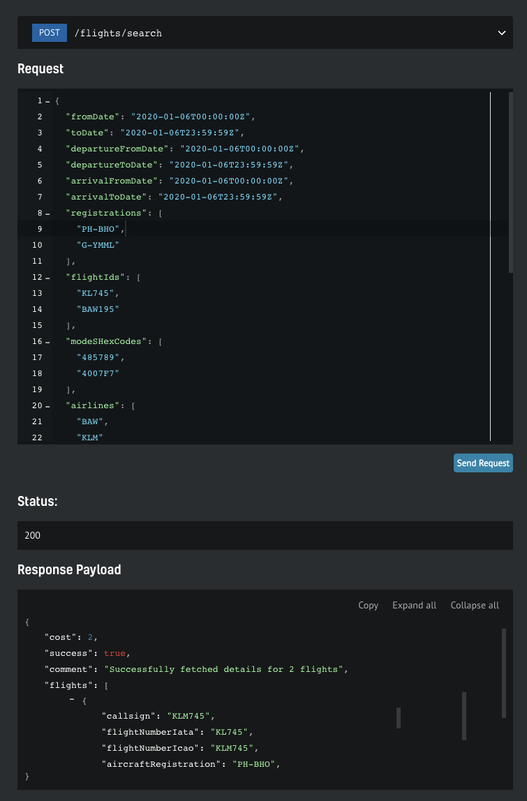
The Image Above: Screenshot of Flight Data from the API Documentation page
In the screenshot above, flight history data was requested for January 6 from 00:00Z to 23:59:59 Z for airplanes with registration "PH-BHO" and "G-YMML", which performed the KLM745 and BAW195 flights. You can get the flight history data for any flight and aircraft, anytime and anywhere.
2. Live flight (British Airways - Boeing 777-236ER - G-YMML)
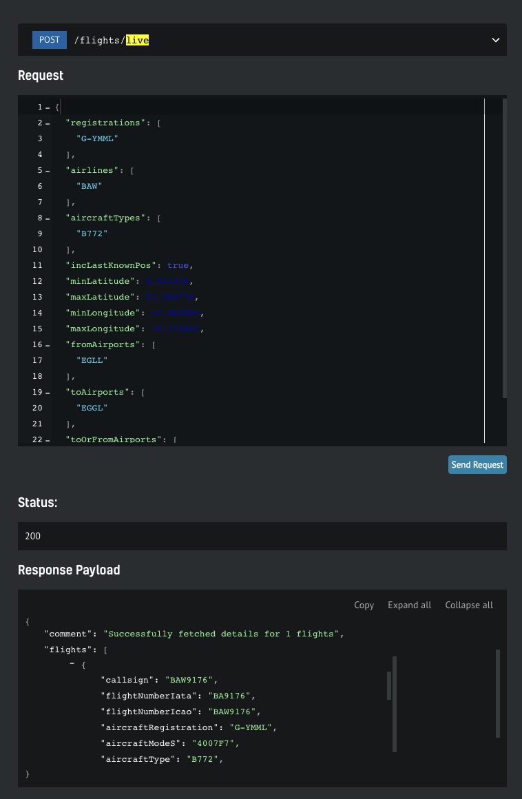
The Image Above: Screenshot of Flight Data from the API Documentation page
With RadarBox On-Demand API live flight endpoint you can get live data from any flight or particular aircraft around the world. In the example, flight data for the British Airways Boeing 777-236ER (G-YMML) has been requested, which will display flight, aircraft speed, altitude, altitude, and longitude information. The Boeing 777 operated by British Airways, for which the data was requested, was operating flight BAW1976 at that time.
3. Search flights by geographical area (latitude & longitude)
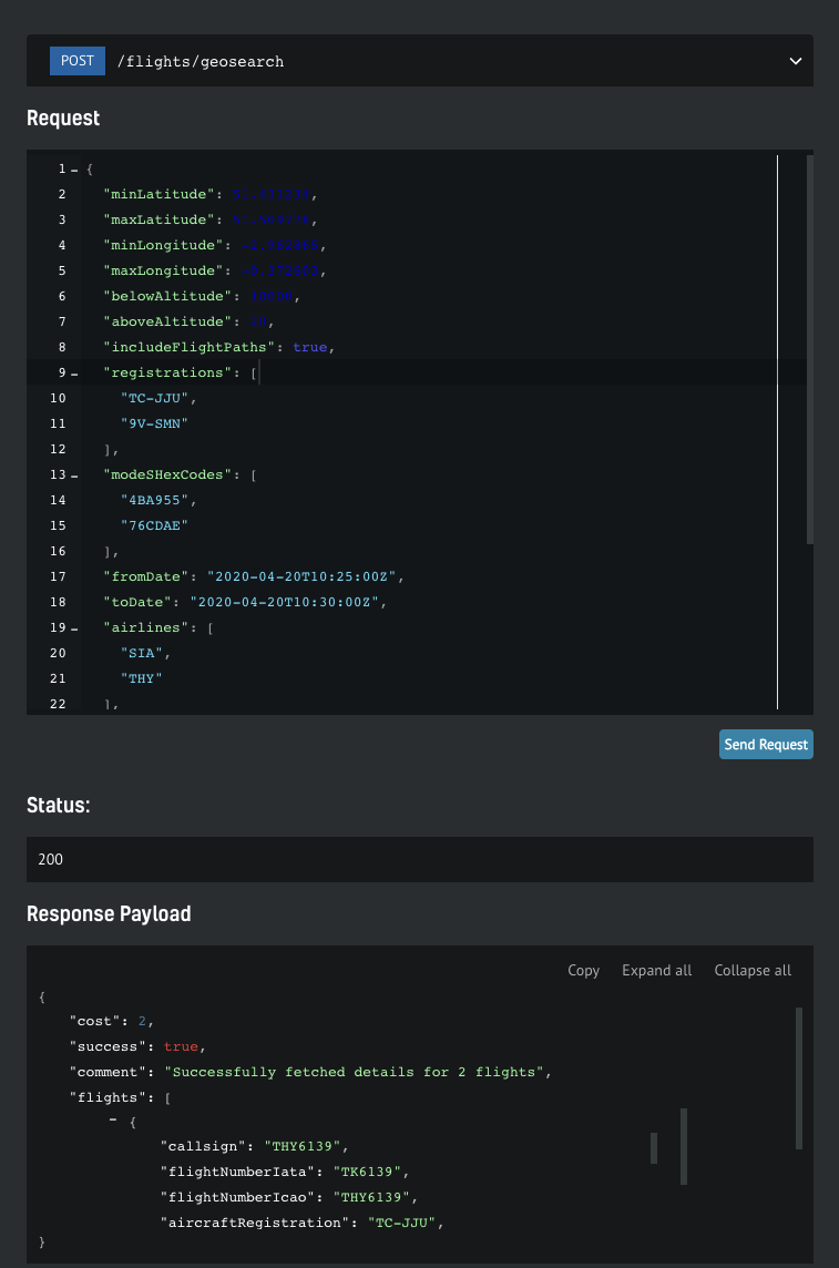
The Image Above: Screenshot of Flight Data from the API Documentation page
With the flight by geographic region endpoint, you'll be able to find out which flights, airlines flew over a certain area or geographic region on a certain day, time, among other information.
In the example above, all flights between latitudes 51.43 and 51.50 N, minimum longitude -2.96 and maximum longitude 0.37, altitudes below 10,000 feet and above FL20 (2,000 feet) were requested for April 20 from 10:25 Z to 10:30 Z (UTC). Two aircraft were captured flying over the chosen area and time, "TC-JJU" and "9V-SMN". Turkish Airlines Boeing 777-3F2ER operating flight THY6139 from Istanbul (IST) to London (LHR). Flight history data or real-time flight data can be obtained anywhere in the world.
How to use RadarBox On-Demand API
Getting your free token
You get a free token with your business account, which will give you enough credit to play. You can find yours by navigating to your API Dashboard. Once you have it, open up the API documentation in a new tab so you can keep reading the how-to guide here
Step-by-step guide
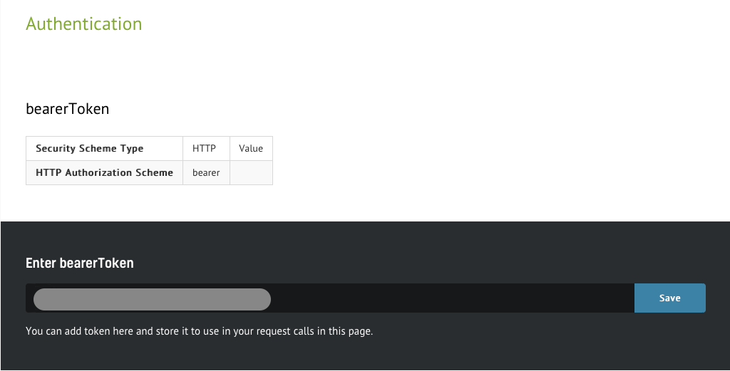
1. Authenticate
The Image Above: Screenshot of Airspace Data from the API Documentation page
The steps below will show how easy it is to interact with the API. On the documentation page, you'll be able to scroll through the specs. Every call needs to be authenticated, so you need to put the token you wish to use in context. Simply insert the token in the designated form and hit "Save" button. From here on, all service calls will be associated to your account.
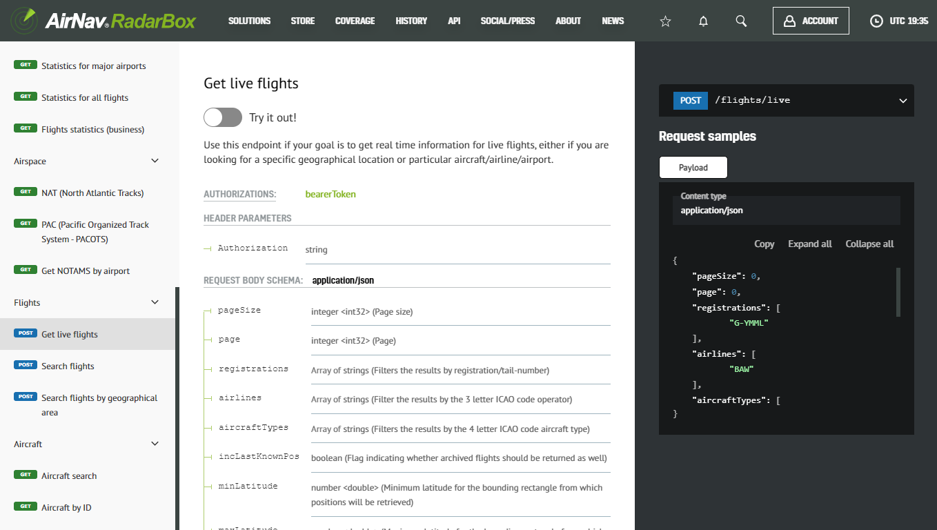
2. View all available services
The Image Above: Screenshot of Airspace Data from the API Documentation page
In the left menu, you can find a list of the available services. Clicking on each one will take you to the endpoint details, where you can find information such as required parameters and the detailed format of the response.
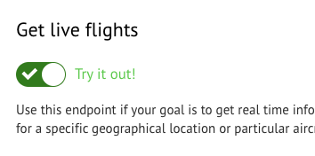
3. Enter testing mode
The Image Above: Screenshot of Airspace Data from the API Documentation page
Click the “Try out” button, which will activate the test mode, and you will be able to submit live requests.

The Image Above: Screenshot of Airspace Data from the API Documentation page
Once you’re in test mode, you will have the request spec on the center column and a text box with the payload of your request on the right. It will be pre-filled with test values which you will need to customize.
4. Sample test case
One of the simplest scenarios is trying to find out what the current position of a specific aircraft is.
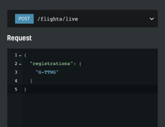
The Image Above: Screenshot of Airspace Data from the API Documentation page
We have edited the sample payload stripping everything except our criteria: get the current position for the aircraft with tail number G-TTNG. After hitting the “Send Request” button, we should get a response within seconds. If all goes smoothly, we should see the status code of the request and the response payload popping up below the initial request.
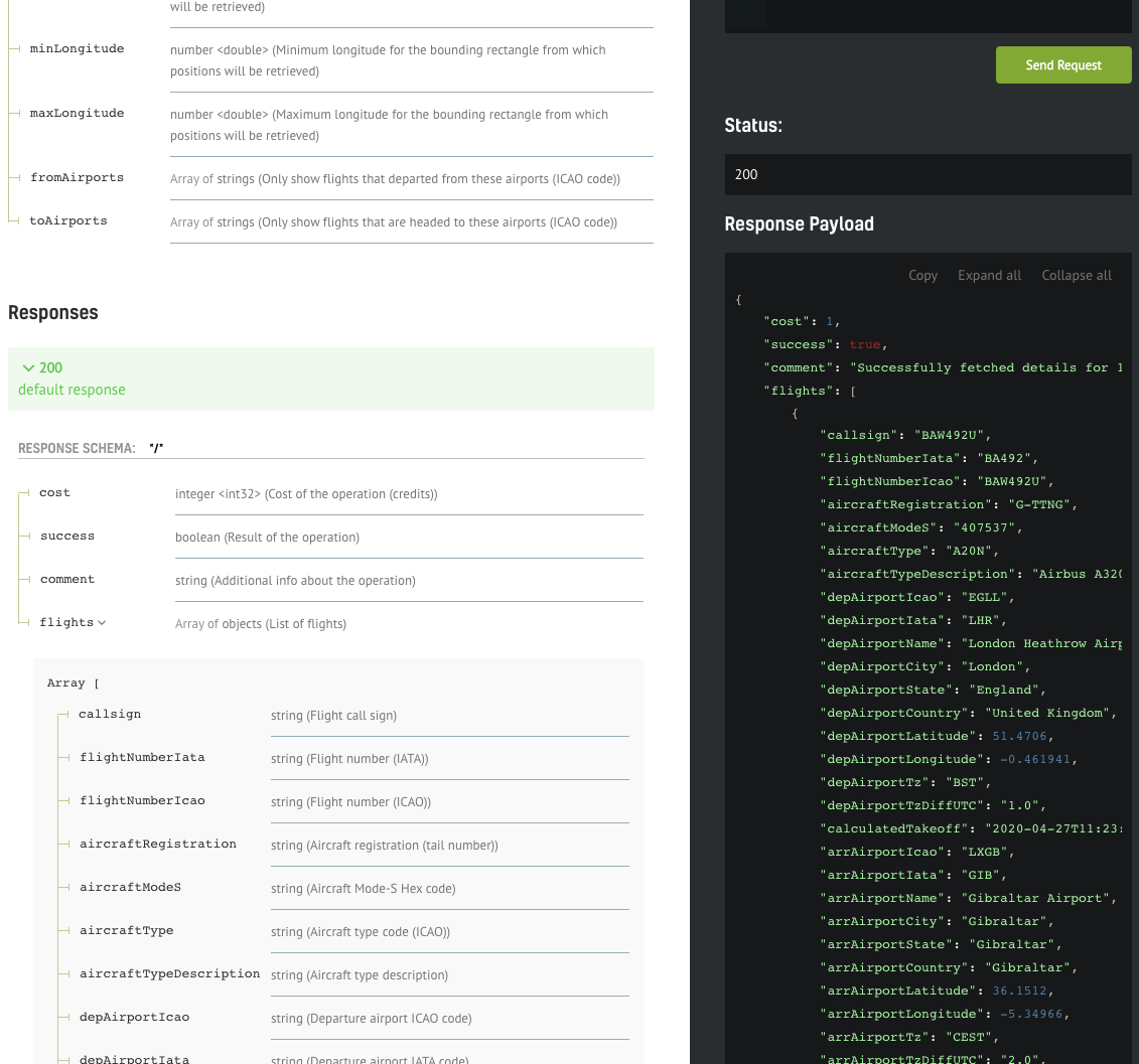
The Image Above: Screenshot of Airspace Data from the API Documentation page
The documentation of the response fields should be visible on the left of the response payload, making it easy to interpret the data.
Implementing your own client
The interface shown above is great for prototyping your calls, but of course, you still need to implement your own API client. We will show how easy it is to have a full Python API SDK working with only a few lines of code.
.png)
The Image Above: Screenshot of Airspace Data from the API Documentation page
You can download the web service client in your favorite language/framework - we currently support the most popular ones such as C#, Java, PHP, Python, Scala, Swift, and Javascript.
Simply select your option from one of the items in the dropdown menu, and the download will start automatically. Once complete, you need to extract the archive and open the contents in your favorite IDE.
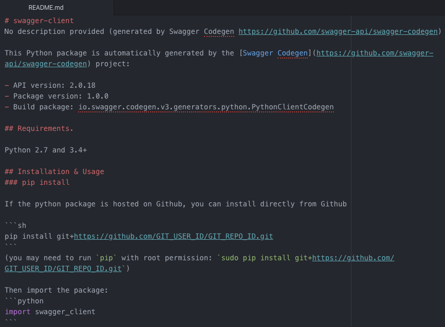
The Image Above: README.md Document
The README.md file contains valuable information and is tailored to the framework we're interested in. In this case, there are instructions on how to setup up your Python environment in order to be able to run the API client smoothly. There are also code snippets that you can copy/paste directly to your code.
The Image Above: README.md Document
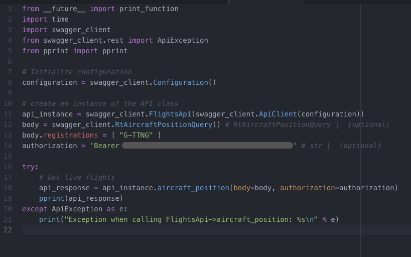
We have copied the snippets from the README file into our own file "liveflights-client.py" and we only needed to add two things: the authentication string (bearer token) and the search parameter (registration "G-TTNG"), same as the call we have previously created in the testing interface.
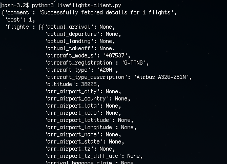
The Image Above: README.md
After saving the file, we can open up a terminal and use Python to run the client we have just implemented.
What differentiates us from our competitors?
“What differentiates AirNav Radarbox from its competition is what we call AirNav's 3 F's. Flexibility in dealing with each of our customers' requirements. Building Feature-rich and Future-ready products, while focusing on customer satisfaction.” - Andre Brandao, CEO of AirNav Systems.
Customizability means that all solutions are tailored to the client's specific requirements. Our seamless integration into existing client applications and platforms through the offering of ADS-B, FAA SWIM, Oceanic, MLAT, Satellite ADS-C, HFDL, ADS-C, Satellite ADS-B to ensure complete and accurate data means we can offer a lot at relative ease.
Through our offering of multiple data formats such as JSON, XML, CSV, KML, ESRI, and others, we also offer more volume of data for less, which is what makes us stand out from the rest.
Finally, we have 24/7 around-the-clock customer support to help you pick the right package to meet your requirements.
So why not look into what we can offer you here at AirNav RadarBox? To get in touch with us, click here to find out today!
READ NEXT...
 76962
76962Tracking Helicopters With RadarBox
Today we'll explore how to filter and track helicopters on RadarBox.com. Read this blog post to learn more...- 30241
AirNav Announces Coronavirus Related Data & Graphics Available
AirNav Systems is providing data COVID-19 air traffic related data for analysis, study and use.  21402
21402Replay Past Flights with Playback
AirNav RadarBox officially launches the playback function on RadarBox.com, allowing users to replay the air traffic for a specific date and time in the past, within a 365-day period. Read our blog post to learn more about this feature.