Introduction
RadarBox is a flight tracking company that displays aircraft & flight information in real-time on a map. RadarBox offers flight data such as latitude and longitude positions, origins and destinations, flight numbers, aircraft types, altitudes, headings and speeds. Based in Tampa, Florida, with a R&D center in Europe, RadarBox’s business operations include providing related data to aviation service providers worldwide.
Along with flight tracking, the website also displays arrival & departure information and historical flight data. Data is aggregated from 14 different sources such as Ground and Satellite based ADS-B, FAA SWIM, EUROCONTROL, MLAT, FLIFO, ACARS/Datalink and ADS-C. A large network of volunteer feeders in all parts of the world feed ADS-B data using ground receivers provided by RadarBox. As of January 2021, the company has over 20,000 feeders who actively share data to the website.
Our Story
RadarBox was founded by Computer Sciences Engineer and Airline Pilot Andre Brandao in early 2001. Under his leadership, RadarBox grew significantly over the next couple of years, primarily due to strong investments towards a feature rich website, apps and hardware innovation.
Today, the website has over 150,000 daily users in over 190 countries. The parent company of RadarBox is AirNav Systems LLC (established in 2001).
Our Clients
Operating one of the world's biggest ADS-B networks, AirNav RadarBox has established itself as a flexible and easy to deal with company. We not only provide off-the-shelf solutions but also develop customized applications suitable to all types of companies.
Some of our most recent and important customers.
 |
 |
 |
 |
 |
 |
 |
|
 |
 |
Our Offices
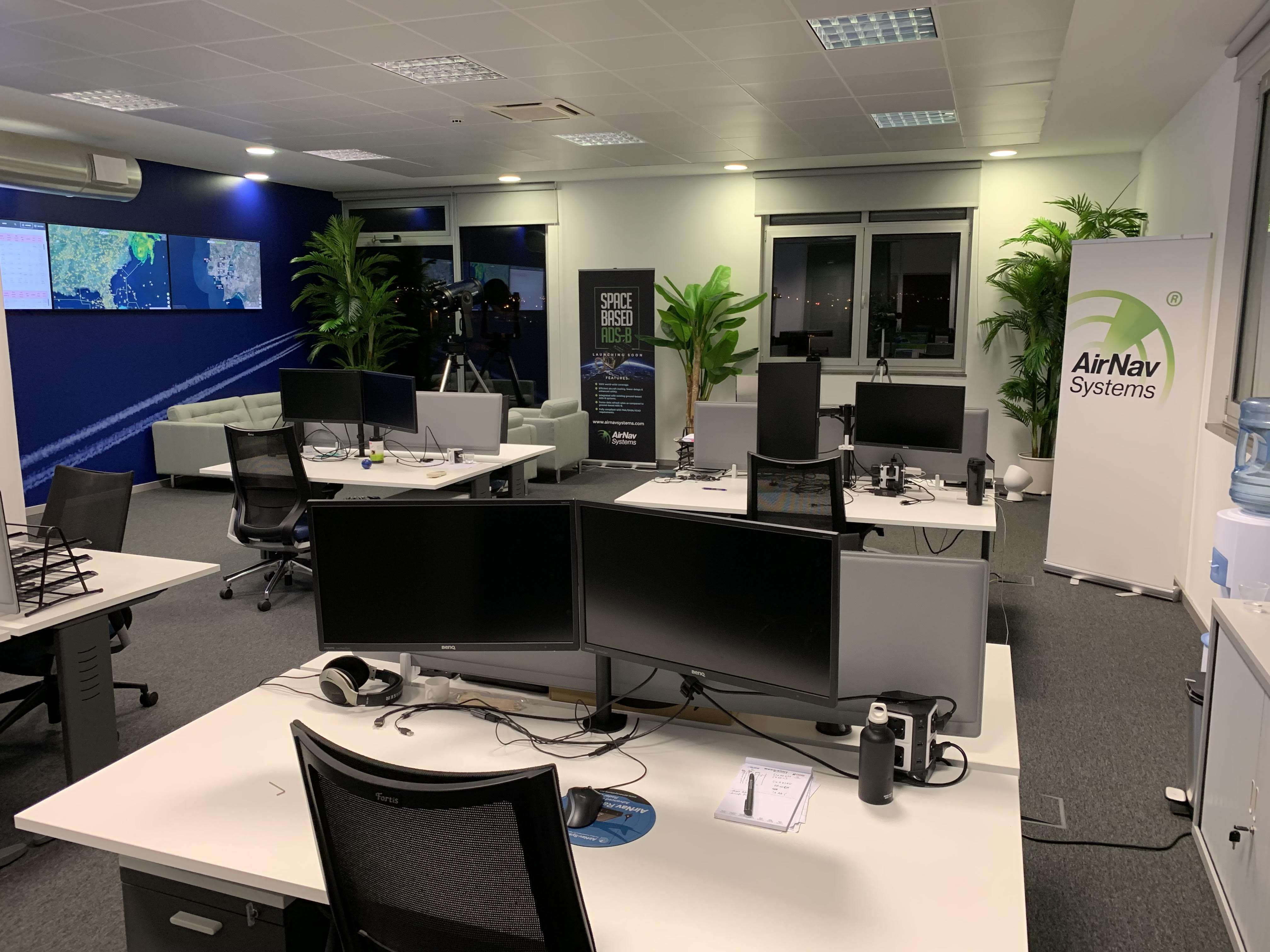
With offices in the US and in Europe we have team members from over 10 countries with all types of backgrounds - air traffic controllers, airline pilots, engineers - in common AirNav Systems team members have a passion for aviation and a deep understanding of big data computing.
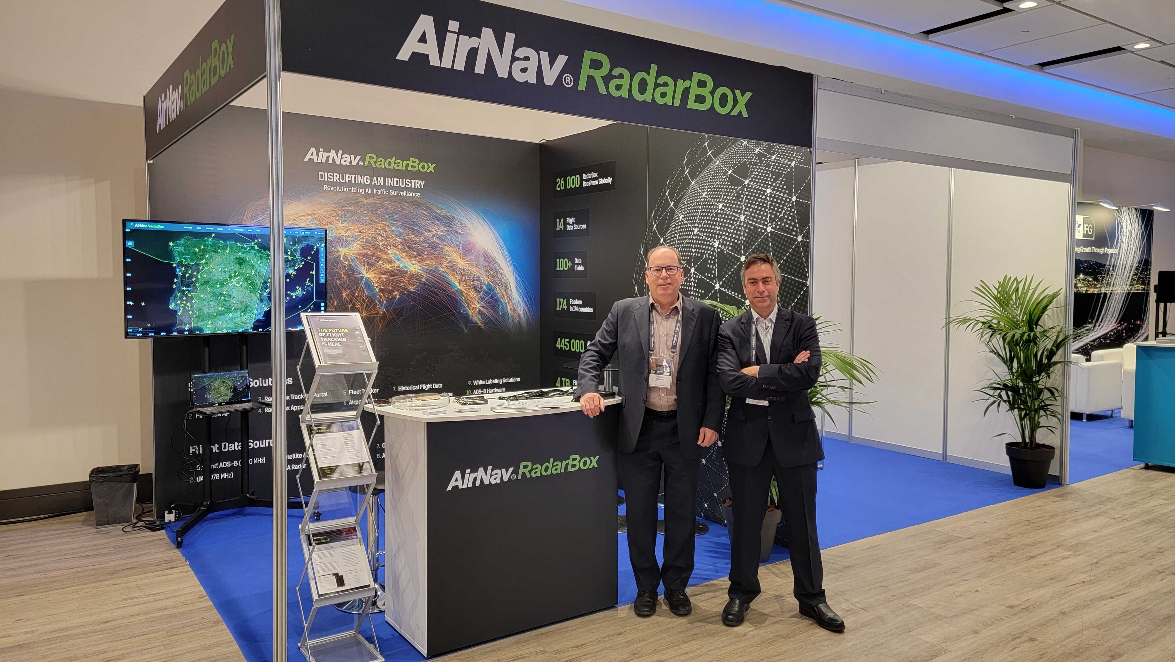
NBAA BACE 2021 Convention (Las Vegas, USA)
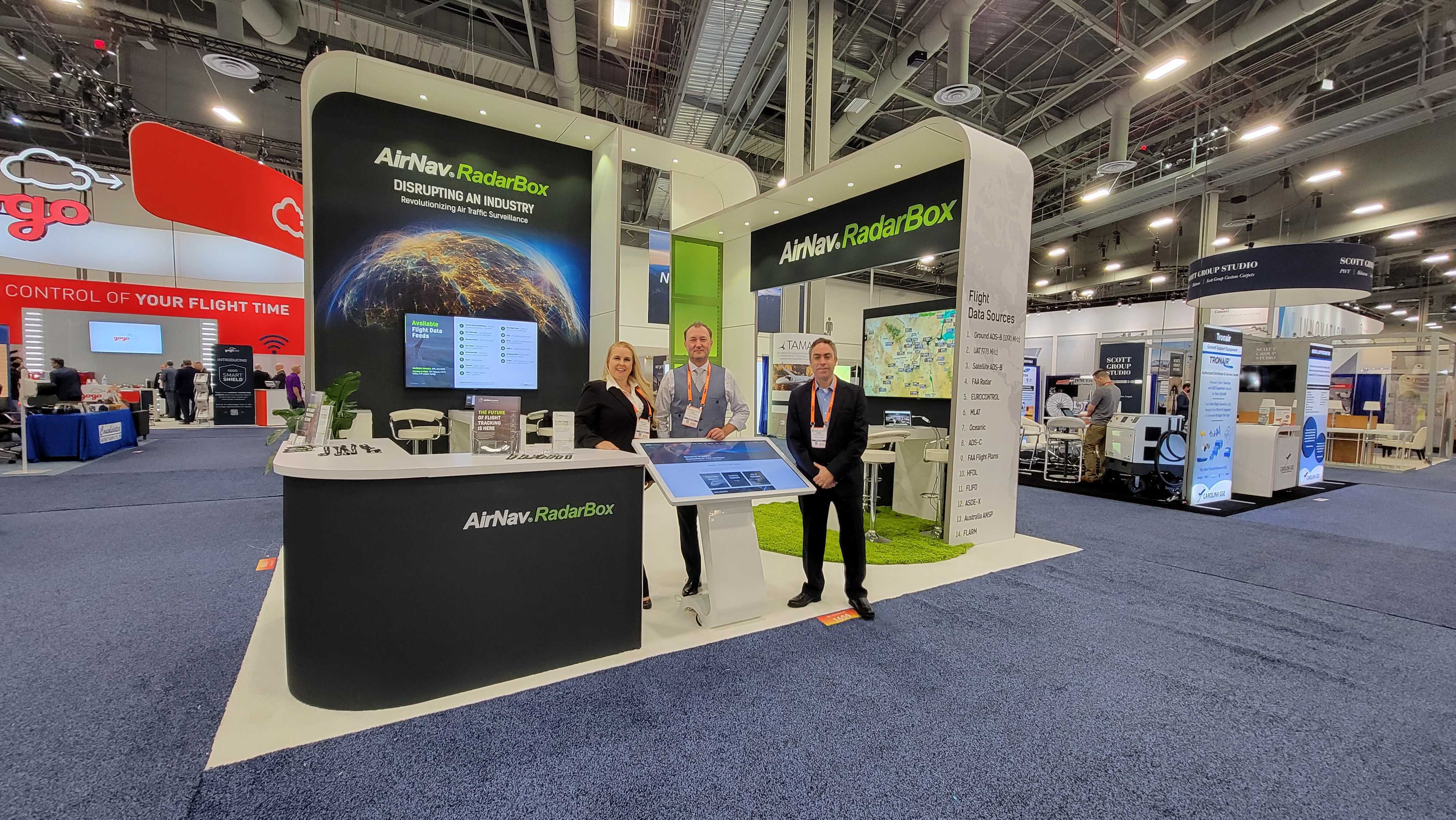
AirNav Systems exhibiting at the NBAA - BACE 2021 convention in Las Vegas, USA.
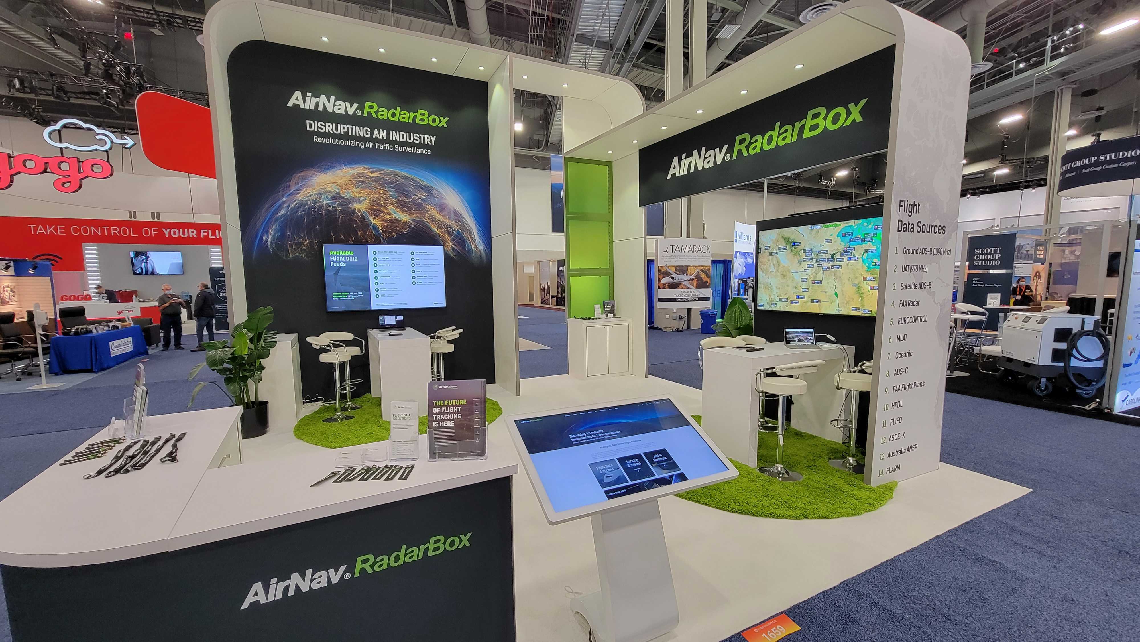
AirNav RadarBox Booth at NBAA - BACE 2021 convention in Las Vegas, USA.
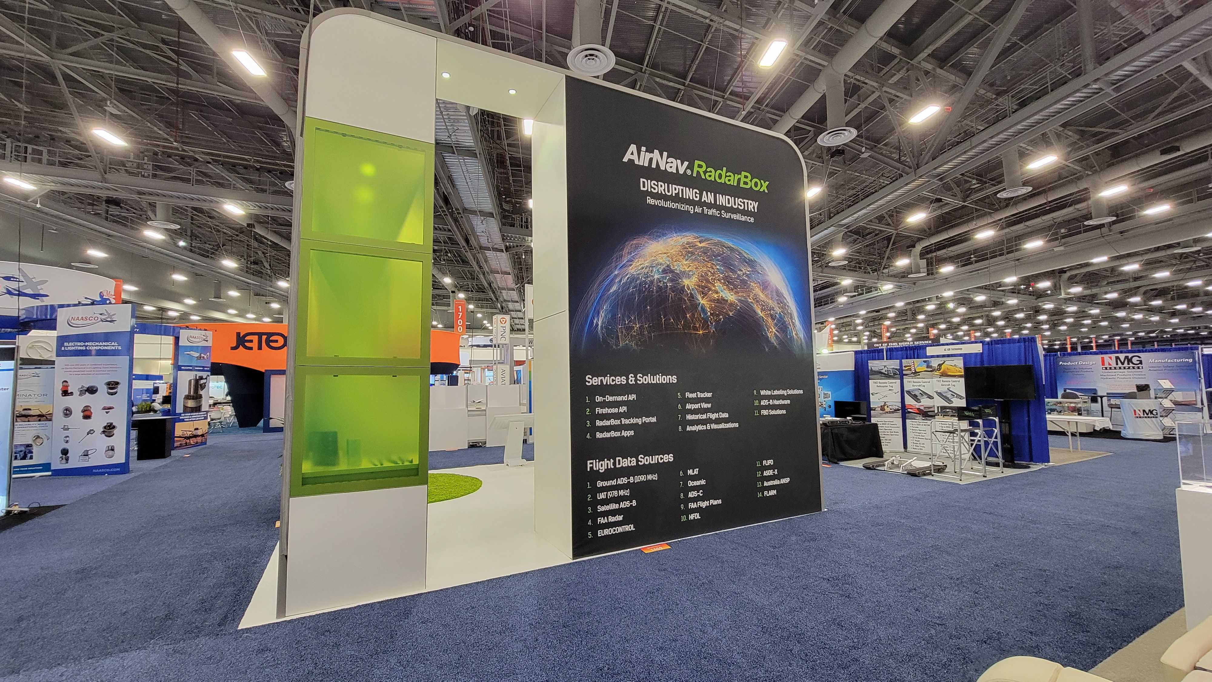
AirNav RadarBox Booth at NBAA - BACE 2021 convention in Las Vegas, USA.
IATA - DDRS 2021 Symposium (Madrid, Spain)
AirNav Systems exhibiting at the IATA - DDR 2021 Symposium in Madrid, Spain
Flight Tracking – On the Ground
Automatic Dependent Surveillance - Broadcast (ADS-B) tracking is a modern flight tracking system wherein the electronic equipment onboard an aircraft automatically broadcasts the aircraft’s location other flight related data to ground receivers via radio waves.
The data transmitted to ground receivers can then be used by other aircraft and air traffic control to show the aircraft’s position and altitude on display screens without the need for radar.
The system involves an aircraft with ADS-B determining its position using GPS. A transmitter (also called Transponder) then broadcasts that position at rapid periodic intervals, along with aircraft identity, altitude, speed and other data. Dedicated ADS-B grounds stations (or ADS-B Receivers) receive the broadcasts and relay the information to RadarBox’s servers which then process and display this data at www.RadarBox.com. Most of these ground stations consist of receivers that RadarBox sends volunteers, free of charge.
ADS-B is based on the line of sight principle, so coverage area primarily depends on the antenna – how it is placed, where it is placed, and obstructions like buildings, mountains etc. around the antenna. The average range of a typical feeder’s antenna is 100-200 nautical miles (NM).
Tracking flights over the ocean is a challenging task as receivers cannot be placed in the ocean. Fortunately, RadarBox has a network of feeders living in coastal regions and on islands such as the Azores, Iceland, Fiji, etc. This helps us track flights at least 100-200 NM off a coast. Our new satellite tracking solution, scheduled to be released in 2018/2019, will solve this problem.
All aircraft equipped with an ADS-B out transponder are tracked. Military and selectively blocked aircraft are also tracked but are not displayed to the public.
Flight Tracking – From Space
Satellite ADS-B is one of the newest innovations in the industry, as it allows tracking of aircraft over extremely tough terrain, wide expanses of water bodies, and in places where ground-based ADS-B systems simply cannot get through.
AirNav Systems’ Satellite ADS-B network uses data from receivers that are placed on nano-satellite constellations in space to carry out tracking, thereby enabling non-stop global air traffic surveillance regardless of terrain, location or infrastructure. Tracking is unaffected by weather or other natural phenomenon. Aircraft are not required to have any special equipment on board their aircraft or fleet other than an ADS-B out transponder.
By complimenting the existing ground based ADS-B network, space based ADS-B will be able to provide a more complete picture to the users on the ground. Moreover, aircraft are not required to have any special equipment on board their aircraft or fleet other than an ADS-B out transponder.
Coverage Map
RadarBox has coverage only in areas where a feeder volunteer has installed one of our ADS-B receivers or shares data with their Raspberry Pi or similar devices. However, with new feeders added every day, our network is growing fast. To become a feeder, visit www.radarbox.com/addcoverage
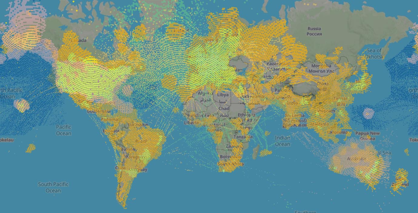
Currently over 80% of European & US airspace is covered by ground stations. Asia, Africa and Australia have seen significant growth during the last years, with more feeder volunteers signing up and feeding ADS-B data to RadarBox.
Data Sources
Flight data is aggregated from 14 different sources, to ensure tracking continuity, accuracy, and redundancy. These sources include data from ANSP's, Satellite based ADS-B data, national & transnational data feeds such as EUROCONTROL & FAA SWIM and AirNav's own global terrestrial network of over 27,000 ADS-B receivers. Learn more about AirNav’s data sources here.
Accounts
At RadarBox, we know quite well from past experience that “one size doesn’t fit all”! Which is why we’ve tailored our subscription accounts to best suit the needs of the different users who visit our site.
Below, you’ll find a list of Subscription Accounts that we offer with a description of the type of user it caters to.
| Account Name | Monthly Fee | Description |
|---|---|---|
| Basic | Free | Basic flight information, limited features, time–outs and ads. |
| Spotter | $2.45 | Tailor made for aviation enthusiasts and plane spotters. Get access to our premium mobile apps, filters and no time-outs. |
| Pilot | $7.95 | Ideal for pilots, ATC controllers & dispatchers. Weather layers, SkyVector, ATC Boundaries & NavAids make this plan the professional's choice. |
| Business | $39.95 | Meant for businesses such as airports and airlines. Experience our exclusive fleet tracker, access to raw & historic flight data and much more. |
| Feeder | FREE | Feeders who feed data to RadarBox get a complimentary Business subscription for as long as they feed data to the website. |
Business Accounts
RadarBox Business accounts have been designed keeping in mind the requirements of FBO’s, aircraft owners and aviation related businesses such as airlines and airports. Benefits include access to a year of historical flight data, the Fleet Tracker, where owners & operators can track their fleet, the Airport View which can assist FBO’s with inbound and outbound flight management, and access to raw flight data. Business accounts also include the features of all of the lower tier accounts.
Business users can additionally opt to hide their aircraft or fleet from public on our website and apps, while making their aircraft exclusively viewable in their account.
Why Subscribe?
RadarBox offers a number of exclusive features to users who subscribe to the Spotter, Pilot and Business accounts. Features for each account vary based on the account a user chooses, but the following 8 features are included by default for every paid account irrespective of the account the user chooses.
- 1. No time-outs
- 2. Ad free experience
- 3. Full Flight Card view
- 4. Premium App access
- 5. View Historical Flight data
- 6. Access to 5 different map types
- 7. Store Discounts
- 8. Priority Customer Support
Using the Website
How do I track flights?
- To track a flight, users simply need to visit www.radarbox.com
- Then either search for a particular flight using the search option, or click on any aircraft displayed on the map to obtain its flight details.
- Users can view the route and heading of the aircraft on the map, while the flight card provides the aircraft's flight data, such as altitude, speed, etc.
- The Customization Bar on the right side of the screen allows for users to choose the map they like, filter flights and listen to live ATC Radio.
How does the filter option work?
- The filter option can be found on the Customization Bar on the right side of the screen.
- Using the filter option, users can filter by flight altitude, speed, data source and status.
- Filters are applied by dragging or clicking the toggle button under the respective filter.
- Once a filter is applied, the corresponding result will be displayed on the screen.
- For example, if a user wants to only see flights that are flying above 30,000 feet, the user just needs to drag the altitude button to 30,000 feet and the user will only see flights that are above 30,000 feet.
How can I search for a flight?
- The search option (magnifying glass) can be found on the right side of the screen, next to the customization bar.
- All the user has to do is type in the name of the airline, flight number or airport / airport code for the site to display the desired search result.
What is Fleet Tracker & Airport View?
- Fleet Tracker allows airlines and aircraft fleet owners keep track of their aircraft fleet via a dedicated tracking page. This feature is only available to users who sign up for a business account.
- Airport View is a dedicated page that displays outbound, inbound and aircraft on the ground for a single airport. This feature was primarily designed for airports, controllers & FBO’s.
What does the Flight Card display?
- Flight Number, Registration & Logo – The aircraft’s flight number, registration number, airline logo are displayed.
- Origin & Destination – The flight’s origin and destination airports are displayed.
- Altitude, Latitude & Longitude – The altitude (feet), latitude & longitude is shown.
- Ground and Vertical Speed – The ground speed is the horizontal speed of an aircraft. The ground speed is indicated in knots. The vertical speed is also known as the rate of climb and descent. It indicates the speed, in feet/minute, at which the aircraft is climbing or descending.
- Mode-S and Squawk - The Mode-S code is a worldwide unique code that identifies the aircraft. The squawk code is a 4 digit unique identifying code for ATC.
- Data Source & Station - The data source displays the current source of the flight’s data, whether it be ADS-B, SatCom ACARS, ASDI, MLAT, etc. The Station shows the current feeder unit or station that the data is being received from.
- Route and Cockpit View - The route view singles out the selected aircraft on the map and displays its current & planned route. The cockpit view gives the user a 3D simulated view similar to what the pilot would see from the cockpit.
Feeding Data
Why Feed Data to RadarBox?
When you choose to feed to RadarBox, you are not just increasing coverage in your geographic area, you are also helping us “lighten up black spots in the sky”. The process is a breeze and we take care of all shipping & customs costs. By sharing data you help:
- Increase local & global coverage.
- Help make skies around the world safer.
- Be a part of a large ADS-B feeder community.
- Help millions of people track family & friends when they fly.
To those who already share data with us, we want to thank you for helping make our skies safer. To those mulling the idea, we urge you to join us. Your choice to share real-time data benefits millions across the globe of people who use our service to track flights every day.
Become a Feeder
Firstly, congratulations on your decision to feed data to one of the largest flight tracking companies in the world. And welcome to the global community of ADS-B feeders.
There are 3 ways you can feed ADS-B data to RadarBox.
- Apply for and feed data via our X-Range ADS-B receiver.
- Build your own receiver using a Raspberry Pi.
- Feed data via your Windows computer using a software application such as AirNav RadarBox or PlanePlotter.
Before we send you a receiver, you’ll need to make sure that you can fulfil the following requirements.
- Feeders should have satisfactory reception conditions with a 360 degree view of the sky.
- Feeders must be able to start feeding / sharing within 1 week from the date of delivery.
- Feeders must be able to keep the receiver online 24/7.
- If the feeder can no longer host our equipment, RadarBox will arrange to ship the receiver back to the company.
Benefits
Listed below are some of the benefits you receive when you feed data to RadarBox.
It’s our way of saying thanks!
- FREE Business Account on RadarBox.com.
- Free Premium app access
- Access to New Beta Features.
- Up to 25% off on our store products.
- 24x7 Priority customer support.
The Application Process
These processes are explained in brief below.
1. Apply for and feed data via our XRange ADS-B receiver.
- To apply for an XRange receiver, fill out our application form found here: www.radarbox.com/addcoverage
- After a quick review of your application, your receiver will be shipped out to you.
2. Build your own ADS-B receiver using a Raspberry Pi.
- To build your own receiver, simply follow the instructions found on these 2 links: www.radarbox.com/blog/radarbox24-raspberry-pi-client / www.radarbox.com/raspberry-pi/guide
3. Feed data via your computer using PlanePlotter or AirNav RadarBox for Windows.
- If you wish to feed data via PlanePlotter or AirNav RadarBox for Windows, you’ll need a generic USB DVB Dongle or an AirNav FlightStick, which can be purchased here on Amazon or Ebay.
- Purchasing the setup will set you back about $10 - $15, but bear in mind that once you start feeding to RadarBox, you’ll be given a complimentary subscription of our Business account that retails for $39.95/month.
Once you have your setup all connected and ready, if you choose the AirNav RadarBox application for Windows, you will automatically start sharing data to RadarBox.
If you choose PlanePlotter, follow the steps below to start sharing:
- i. Open the PlanePlotter application.
- ii. Click on Options, and click on Sharing, then click Setup.
- iii. Tick the Enable sharing to RadarBox box.
- iv. Change the Cycle Time to 20 seconds.
- v. Then click OK.
- vi. Click Options, then Sharing, then Enable (if it's not checked already).
- vii. Next click the green button on the upper left corner of the PlanePlotter application to start feeding data.
- viii. Once you do that, send us an email with a screenshot and we’ll email your business account details after verifying that your data is being received.
- ix. Email us at [email protected]